Lower Danube River Basin (Bulgaria, Romania, Moldova, Ukraine)
Project ended
Landscape level
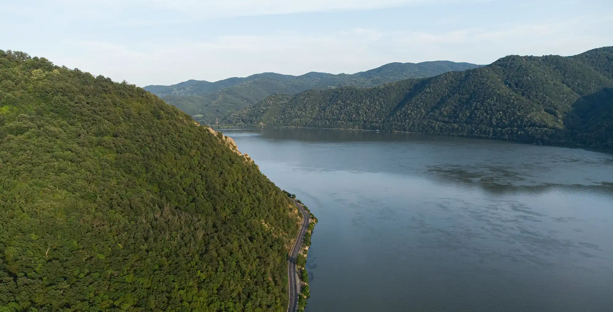
The Lower Danube Green Corridor, initiated in 2000 by Bulgaria, Romania, Ukraine, and Moldova, is one of Europe’s largest transboundary river restoration efforts. It aims to restore 224,000 ha of floodplain and protect 935,000 ha of wetlands and natural habitats to reduce flood risk, enhance biodiversity, and support sustainable livelihoods. More than 60,000 ha of floodplains have been restored to date through reconnecting the river to its floodplains by removing/decommissioning dikes, native forest regeneration, and natural grazing, helping rebuild resilience for both people and ecosystems.
Over the past century, about 75% of the Lower Danube’s floodplains were diked and converted for agriculture, causing loss of connectivity, riverbed erosion, eutrophication, and increased flood and drought risks. Gravel extraction and dams lowered water tables and degraded habitats. Climate change compounds these pressures through more frequent and intense flooding, with potential flash floods during dry periods. Recognizing shared challenges, the four riparian governments established the Green Corridor as a framework for coordinated floodplain restoration and sustainable land use.
The Lower Danube Green Corridor restores floodplain connectivity and wetland ecosystems through dike removal, reforestation, and natural grazing, replacing grey flood defences with resilient green infrastructure. This cross-border initiative balances ecological recovery with economic benefits, enhances flood retention and drought buffering, and strengthens international cooperation for long-term adaptation to climate change.
The intervention was implemented through the Lower Danube Green Corridor Agreement, signed in 2000 by the governments of Bulgaria, Romania, Ukraine and Moldova, to restore floodplain and wetland functions along the approximately 1,000 km lower Danube. The agreement set quantitative targets to restore 224,000 hectares of natural floodplain and preserve a wider area of 935,000 hectares (including enhanced protection for 775,000 hectares of existing protected areas and new protection for 160,000 hectares). WWF led the initiative operationally, acting as an independent organisation with technical know-how and a facilitator role to maintain communication and cooperation between the four countries.
Implementation combined physical reconnection of the river to its floodplains with habitat restoration and invasive species management. By 2020, restoration was underway in more than 60,000 hectares of floodplains. Measures included removing or decommissioning under-performing flood protection dikes to re-establish lateral connectivity and allow the river to resume more natural flow patterns; this also enabled around 750 hectares of land to return to a naturally flooded state. Invasive vegetation was cleared in affected areas, and traditional cattle breeds were introduced in some locations (notably on Tataru Island, Ukraine) to control invasive plants through grazing. In parallel, tens of thousands of native trees were planted across dozens of small sites to support riparian woodland recovery, with the intention of enabling natural forest regeneration over a wider area. Along the Romanian stretch, floodplain reconnection was implemented in several locations, including 6,000 hectares on the islands of Babina and Cernovca and at sites such as Mahmudia, Balta Geraiului, and Gârla Mare–Vrata, creating a mosaic of habitats as natural processes were re-established. Some projects were still ongoing as of 2020, including Gârla Mare and Vrata, expected to affect around 2,000 hectares.
Governance and delivery relied on national action planning and structured cross-border coordination. Each country prepared an action plan that designated additional floodplain areas for protection and restoration and set out, for each area, the specific measures required and the steps to implement them. Regular information exchange was supported through meetings and by establishing contact points within the Ministries of Environment in each participating country. WWF also supported the implementation of concrete restoration projects as models intended to be scaled up. Citizens and environmental NGOs were offered opportunities to participate in decision-making processes, supported by WWF awareness-raising and public engagement, alongside lobbying at national and international levels to strengthen implementation.
A key practical obstacle was land ownership and the need to secure acceptance of land-use change, particularly where reconnection would reintroduce flooding. For each restoration site, a small number to a dozen landowners (depending on site size) had to be convinced that changing land use would be beneficial, and private landowners needed assurance that they would not lose property rights. WWF initiated pilot projects in Romania in which local communities and individuals agreed to allow their land to be flooded; acceptance was linked to recognising the benefits of converting unproductive arable land into wetlands. The documentation also notes that political changes created an ongoing challenge for WWF in sustaining authority buy-in for nature-based approaches, and that political will in each country was considered decisive for moving from agreement to large-scale implementation.
Information not available yet.