Medmerry, Selsey, West Sussex, United Kingdom
Project ended
Landscape level
The Medmerry project realigned coastal defences inland and reopened the coast to tidal processes, creating 184 hectares of saltmarsh and mudflats (plus 263 hectares of other priority habitats). This nature-based solution restores wildlife, reduces flood risk, and delivers public access and wellbeing benefits, while replacing an expensive, frequently failing shingle bank.
Coastal squeeze, sea-level rise and frequent storm overtopping left Selsey and surrounding infrastructure highly vulnerable; over 300 homes, a main road and a wastewater treatment works faced significant flood risk. England has also experienced historic losses of intertidal habitats critical for wave attenuation and biodiversity. The previous shingle embankment breached almost annually and cost around £300,000 per year to maintain. Medmerry sits within a community with many older and low-income residents, making reliable protection and accessible green space especially important.
The Environment Agency, working with the RSPB, constructed a 7 km inland flood bank using ~450,000 m³ of onsite clay and then breached the old shingle defence to allow tidal water to form new intertidal habitats. Clay extraction pits were shaped into freshwater ponds and reedbeds, complementing the saltmarsh and mudflats. Low-density grazing and wildlife-friendly arable management support habitat quality and year-round food for birds. Public access infrastructure enables recreation, education and community involvement alongside improved coastal resilience.
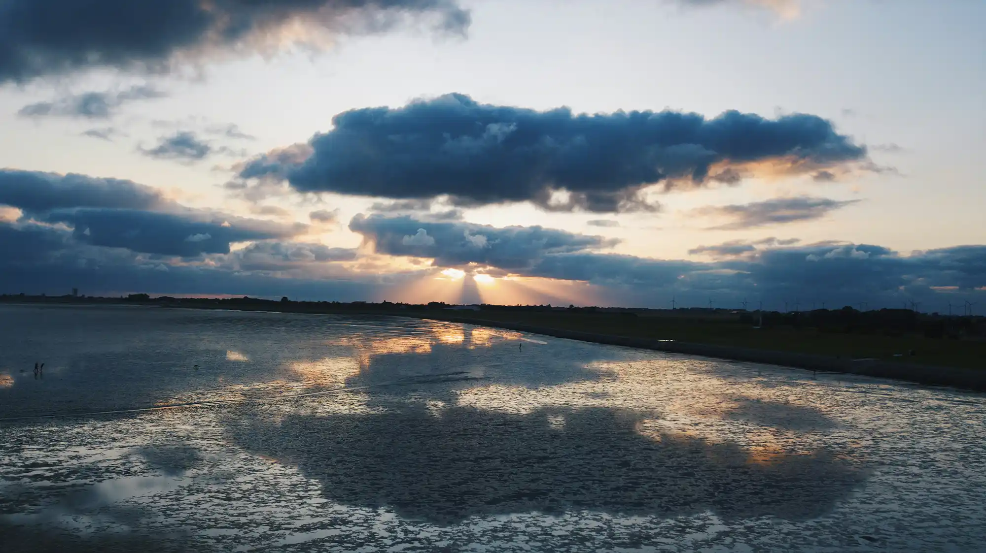
The intervention used managed coastal realignment to replace a narrow, failure-prone shingle embankment with a new inland flood defence and restored intertidal habitat. The Environment Agency delivered the works in collaboration with the Royal Society for the Protection of Birds (RSPB). The core engineering step was construction of approximately seven kilometres of new flood bank inland from the sea, between Selsey and Bracklesham Bay. The bank was built using around 450,000 cubic metres of clay extracted from within the site. Excavation for bank material also created additional freshwater features, including ponds and reedbeds.
Once the inland bank was complete, the existing shingle sea defence was deliberately breached to allow controlled tidal inundation of the area seaward of the new bank. This enabled intertidal processes to re-establish and form approximately 184 hectares of saltmarsh and mudflat (within a wider habitat creation area reported as around 300 hectares, including transitional grassland and other priority habitats). The design leveraged the natural ability of intertidal habitats to absorb wave energy, attenuate storm surges, and accommodate regular tidal flooding while maintaining protection for nearby settlements and infrastructure.
Habitat management was integrated with local farming. Tenant farmers grazed the saltmarsh with sheep and cattle at low density to maintain vegetation structure suitable for wildlife. Farmers participating in environmental stewardship schemes grew cereals and specialist wild bird seed mixes on land adjacent to the saltmarsh, and arable areas were managed to support wildlife through measures such as wild bird seed mixes, nectar flower mixes and cultivated uncropped areas for nesting birds, alongside sustainably farmed tenant land with features such as grassed margins.
Freshwater habitats were maintained through a collective ditch management approach described as wildlife-friendly ditch management. Banks and ditches were managed in rotation to optimise habitat conditions while retaining drainage function, supporting species associated with freshwater margins. Alongside the habitat works, the project delivered associated infrastructure, including a wastewater treatment facility and a road serving around 5,000 residents.
Implementation and longer-term management relied on structured stakeholder participation. The Medmerry Stakeholder Advisory Group was established in 2009 to involve local community interests from the design stage onwards and to address concerns, build trust and support ongoing management. Specialist groups and experts were engaged to address specific challenges, including habitat conservation and preservation of archaeological findings, to avoid delays and resolve stakeholder concerns. Monitoring was designed as a continuous framework to track ecological change and project performance, including regular species monitoring by the RSPB and the use of novel techniques such as satellite imagery; fish stocks were monitored in collaboration with the Inshore Fisheries & Conservation Authority. Site management was subsequently transferred from the Environment Agency to the RSPB.
Information not available yet.