Dutch Wadden Sea coast (Groningen, Fryslân, North Holland, NL)
Ongoing implementation
Landscape level
Under the national Delta Programme (2010–2014), the Wadden Region Delta Programme explored integrating vegetated salt-marsh foreshores with dikes to adapt to sea-level rise while enhancing biodiversity and landscape values. Literature syntheses, modelling (e.g., SWAN), stakeholder engagement, and pilots showed that salt marshes attenuate waves and can reduce future dike reinforcement needs—making them a preferred long-term adaptation strategy. A parallel NbS case study concluded that, in many contexts, man-made marshes are more cost-effective than dike heightening when expected breach damages are small to moderate.
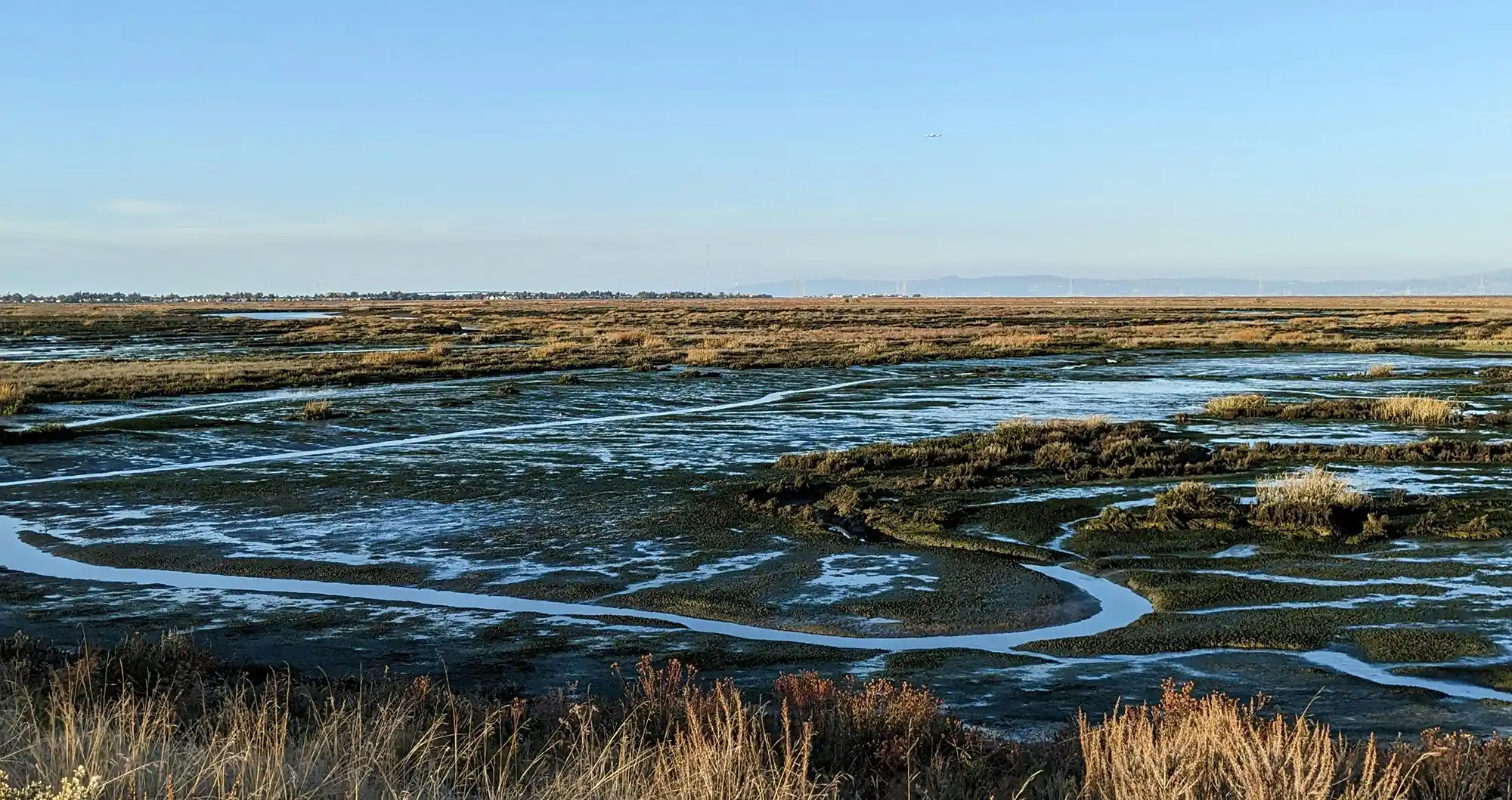
The Wadden Sea—one of the world’s largest intertidal systems—buffers the Dutch mainland via barrier islands, intertidal flats, banks, and salt marshes. ~227 km of dikes (plus the 32-km Afsluitdijk) protect the coast, with design standards up to 1/10,000 year events. Climate change threatens higher surges and waves; if sediment supply lags sea-level rise, intertidal flats and marshes can drown, increasing hydraulic loads on dikes. Semi-natural salt marshes (~9,000 ha) already line much of the shore and provide habitat protected under Natura 2000/UNESCO World Heritage frameworks.
Develop, conserve, and (where suitable) create/raise vegetated salt-marsh foreshores seaward of dikes to dampen waves and complement structural defences. Use sedimentation fields/brushwood dams, earthen breakwaters, and managed grazing to stabilise and shape marshes; ensure marshes can accrete with sea-level rise.
Existing and newly developed salt marshes were explored and used as vegetated forelands to complement the Wadden Sea dike system and reduce hydraulic loading on flood defences. Along the Dutch Wadden Sea mainland and barrier islands, extensive semi-natural salt marshes already existed, largely created through historical accretion works. These marshes were maintained and, where necessary, optimised to stabilise or expand the marsh surface and thereby sustain their flood protection function while remaining compatible with conservation objectives.
Implementation relied on manipulating natural sedimentation and vegetation feedbacks that underpin salt-marsh formation. Historically, sediment accretion on intertidal flats was stimulated by constructing drainage systems in mudflats, planting cordgrass, and building brushwood dams and sedimentation fields seaward of the marsh. Although originally intended for land reclamation, these measures also produced broad vegetated zones that attenuate waves through wave breaking over shallow profiles and friction from vegetation. In the post-1970s shift towards conservation, the size and configuration of sedimentation fields were optimised to halt marsh decline; this coincided with stabilisation and, in some areas, increases in marsh extent along the Frisian and Groningen coasts.
At specific locations, the marsh–dike system was physically integrated in design. A 12.5 km “green dike” section at the Noorderleeg summer polder (completed in 1992) was deliberately designed as a grass-covered dike with adjacent polders and salt marshes, informed by flume studies demonstrating the storm-resistance of a wide vegetated dike/foreland system. In parts of the Frisian coast, summer polders were reconnected to tidal influence either deliberately (by removing sections of a summer dike, as at Noorderleeg) or following breaches (e.g. Paezermerlannen), allowing salt-marsh processes and sediment deposition to continue landward of low seaward defences.
From 2010 onwards, the Wadden Region Delta Programme operationalised this approach through coordinated research and stakeholder engagement rather than a single construction scheme. A coordination group of national and regional governmental bodies and local water boards commissioned literature reviews and modelling, and convened stakeholder meetings to define and prioritise adaptation options. Salt marshes emerged as a priority topic, leading to further modelling (using the SWAN nearshore wave model) to quantify how foreland elevation and width influence wave attenuation under storm and extreme conditions. This modelling was used to translate marsh characteristics into implications for dike design (e.g. potential reductions in required crest height and revetment strength where wave heights are reduced by adjacent forelands).
Spatial implementation planning was supported by a “salt marsh potential map” identifying where marsh development could be pursued based on abiotic prerequisites (notably elevation relative to tidal range, shelter enabling fine sediment deposition, and local hydrodynamics) and biotic constraints (presence of valuable littoral and sublittoral habitats). The map distinguished stretches where salt marshes already occur, where conditions are favourable, and where development would require interventions such as raising elevation via nourishments and, potentially, additional measures to limit erosion or mitigate strong currents and unfavourable depth conditions.
Key implementation obstacles were institutional and technical. Water boards questioned effectiveness during extreme events and raised concerns about maintenance issues (including debris impacts on dike grass cover during storms), while some salt-marsh researchers cautioned about risks to biodiversity and “naturalness” if stability or erosion protection was prioritised for flood safety. A major technical constraint was the limited availability of field data under extreme storm conditions: wave attenuation estimates were largely model-based, with acknowledged uncertainty because models are typically validated using laboratory tests or non-extreme field measurements. Despite these constraints, integration of salt marshes into flood defences was adopted in 2014 as a preferred regional strategy and incorporated into a major dike research programme implemented by northern water boards from 2015. Monitoring of wave attenuation and post-storm indicators (such as debris marks on dikes) was initiated to reduce uncertainty and help reconcile differing stakeholder positions.
Information not available yet.