Kampinos Forest (Kampinos National Park), Mazowieckie Voivodeship, central Poland
Ongoing implementation
Landscape level
Decades of drainage dried the marshes of the Kampinos Forest and contributed to the decline of rare species. Two consecutive initiatives respond to this legacy: Kampinos Wetlands improved water retention around smaller drainage channels in the Kampinos Forest, while Kampinos WetLIFE / Kampinos Wetlands 2 targets large-scale wetland restoration along the western Łasica Canal and the Zaborowski Canal within Kampinos National Park. Together, the projects reflect a shift in land use and management as agriculture declines and more private land is acquired for the park, reducing the economic role of historic drainage networks.
Historic drainage networks from the mid-19th century dried wetlands and reduced rare species in the Kampinos Forest. As agriculture declines and private lands are progressively acquired for the national park, many drains have lost economic relevance. Major canals (Łasica, Zaborowski and others) still evacuate water from adjacent settlements, creating potential conflicts if hydrology is altered. The projects respond by improving in-park retention while preserving flood safety for neighbouring communities.
The projects reduce the drainage role of key canals within park lands while maintaining free outflow of high waters from urban areas. Measures include fixed stone-riffle dams to raise low/medium flows, re-meandering and channel diversification, construction of small ponds for amphibians and invertebrates, and active open-habitat management (mowing, grazing, invasive control). Species-specific actions (reintroductions, nesting platforms, wintering sites) complement hydrological works. Land purchases and sustained communication minimise conflicts with residents.
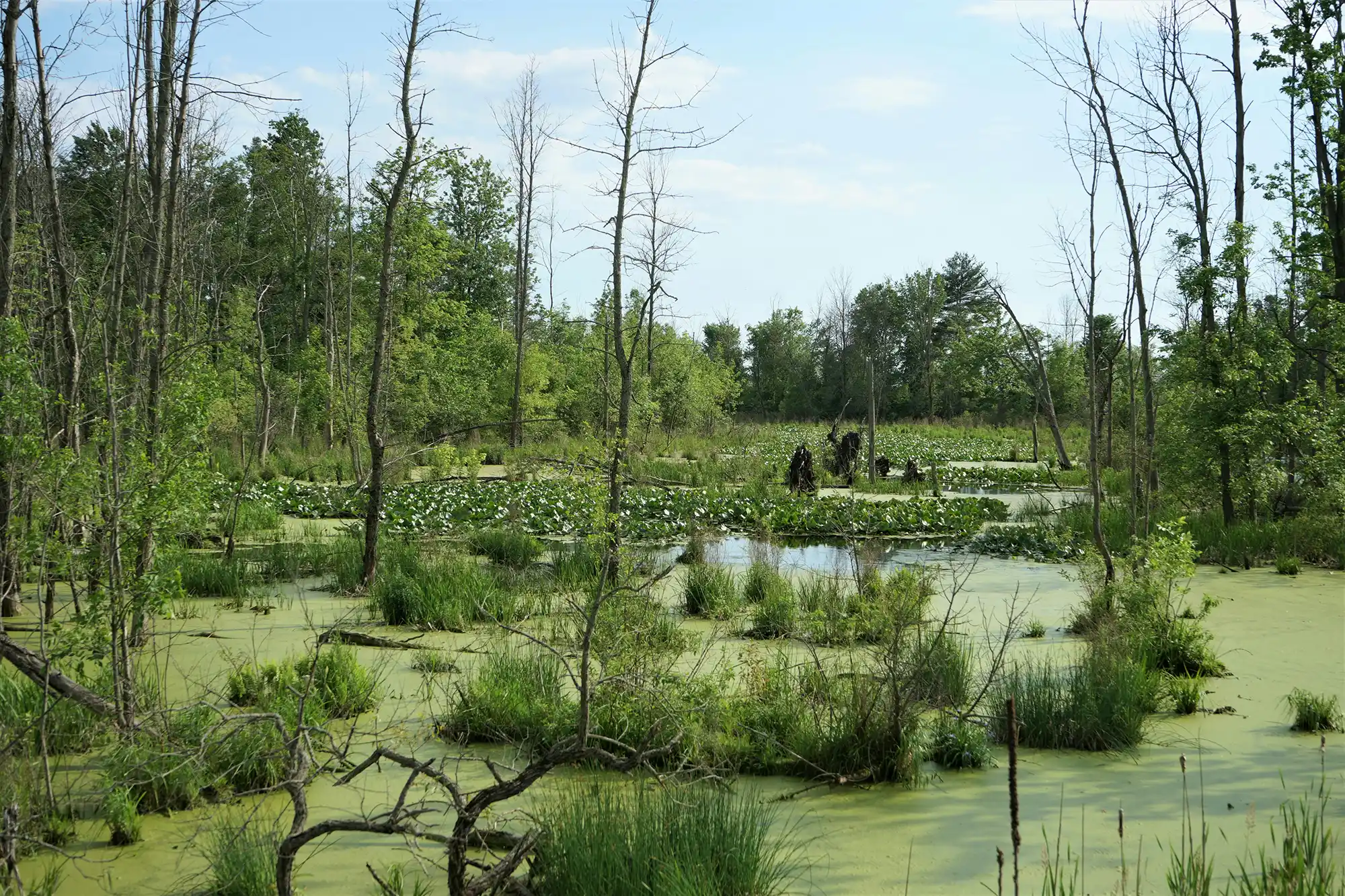
The intervention focused on reversing long-term wetland drying caused by drainage works and adapting the existing water network so that wetlands in Kampinos National Park can retain water while limiting flood risk for nearby settlements. Works concentrated along the western section of the Łasica Canal (from the village of Bieliny) and along the Zaborowski Canal, in wetland areas acquired for the National Park.
Hydrological restoration centred on reducing the drainage function of the main channels in uninhabited forest areas to raise groundwater levels and restore wetland hydrology, including the area’s characteristic braided water circulation in longitudinal depressions. The core hydrotechnical measures in Kampinos WetLIFE (2020–2026) include the construction of 15 permanent dams on the main watercourses (Łasica, Ł9 and Zaborowski) and 12 dams on secondary channels. These structures are designed to dam low and medium flows while allowing high waters to pass freely, slowing wetland outflow during drought without obstructing flood discharge from urban areas located at higher elevation. Damming height and flow width are planned to improve water conditions for Natura 2000 habitats and species (including maintaining minimum water levels in open-water habitats and increasing seasonal flooding in alluvial habitats, while avoiding over-flooding of other habitat types). The locations are to be selected so that impounded water supplies the wetland depressions associated with the historical hydrological network, and—because damming height cannot be regulated—structures are intended to be placed away from private land to avoid conflicts. A public-facing description indicates that dams will take the form of stone riffles, which are intended to oxygenate water and facilitate fish migration.
Channel naturalisation is another major component, with approximately 8,560 m of canals targeted for hydromorphological restoration. Planned methods include initiating re-meandering, flattening channel slopes, widening selected channel segments and placing natural obstacles within channels to create more river-like forms and diversify channel bottoms. These measures are intended to reconnect water bodies, slow runoff, improve habitat quality for aquatic organisms and ensure more consistent access to water for terrestrial fauna.
To diversify wetland habitat mosaics and provide drought refuges for aquatic life, 35 small ponds are planned for construction or restoration. These ponds are intended to support amphibian reproduction and benefit targeted Natura 2000 species, including amphibians (Triturus cristatus and Bombina bombina) and the aquatic snail Anisus vorticulus. The project also plans seven amphibian wintering areas and the adaptation of 32 cellars/basements for amphibian wintering, alongside reintroduction activities for amphibians into newly created ponds.
Active habitat management is planned to maintain and restore semi-natural open habitats and address ecological degradation driven by succession and invasive species. Actions include initial mowing and grazing to restore extensive use, mowing initiation on 30 ha of meadows, restoration of grazing on 50 ha, shrub removal from 5 ha, and species enrichment (re-seeding) on 28 ha of degraded meadows. These measures are linked to improving conditions for butterfly habitats (reported as 108 ha of potential habitats for Teleius Blue and Large Copper) and broader Natura 2000 meadow habitats.
Species-focused interventions include building 14 nesting platforms for large birds of prey and storks and installing additional facilities to protect nests from land predators, with specific reference to black stork and raptors. For selected invertebrates (Vertigo angustior, Vertigo moulinsiana and Anisus vorticulus), reintroduction is planned following detailed research on existing populations and selection of appropriate sites; the approach is based on ex situ breeding to create 7–10 new subpopulations of each species. The project also addresses invasive predator pressure through trapping of American mink (Neovison vison) along approximately 80 km of watercourses using 20 traps, explicitly aiming to reduce predation on fish, amphibians and birds and to build the capacity of National Park staff to continue control after the project ends. Broader removal of invasive alien plant and animal species is also included where they disrupt ecological balance.
Conflict management with local communities is treated as a core implementation requirement. The project recognises that major canals also drain built-up areas and that residents are concerned about rising water levels on private land. To minimise these tensions, hydrotechnical works are planned to retain water only within areas already purchased by the National Park, with the explicit intent not to change water levels on private land. Where necessary, additional land purchase is planned for the lowest-lying private plots within the project impact area. The intervention is supported by communication and information activities and multi-stage public consultations conducted throughout the project, intended to improve acceptance and to develop workable solutions for co-existence between people and wetlands. In the earlier Kampinos Wetlands project (2013–2019), implementation was supervised by a Steering Committee including local government, Kampinos National Park and the Regional Directorate for Environmental Protection.
Implementation roles were split across partners. REC Polska coordinates the project and leads hydrotechnical measures and social communication. Kampinos National Park is responsible for land purchases (reported as 80 ha of meadows in the WetLIFE phase and 120 ha in the earlier Wetlands project). Warsaw University of Life Sciences conducts environmental monitoring, and the Marshal’s Office of the Mazowieckie Voivodeship supports initiation of wetland protection initiatives in the region and organises the closing conference.
Information not available yet.