Wallasea Island, Crouch and Roach Estuaries, Essex, England, United Kingdom
Ongoing implementation
Landscape level
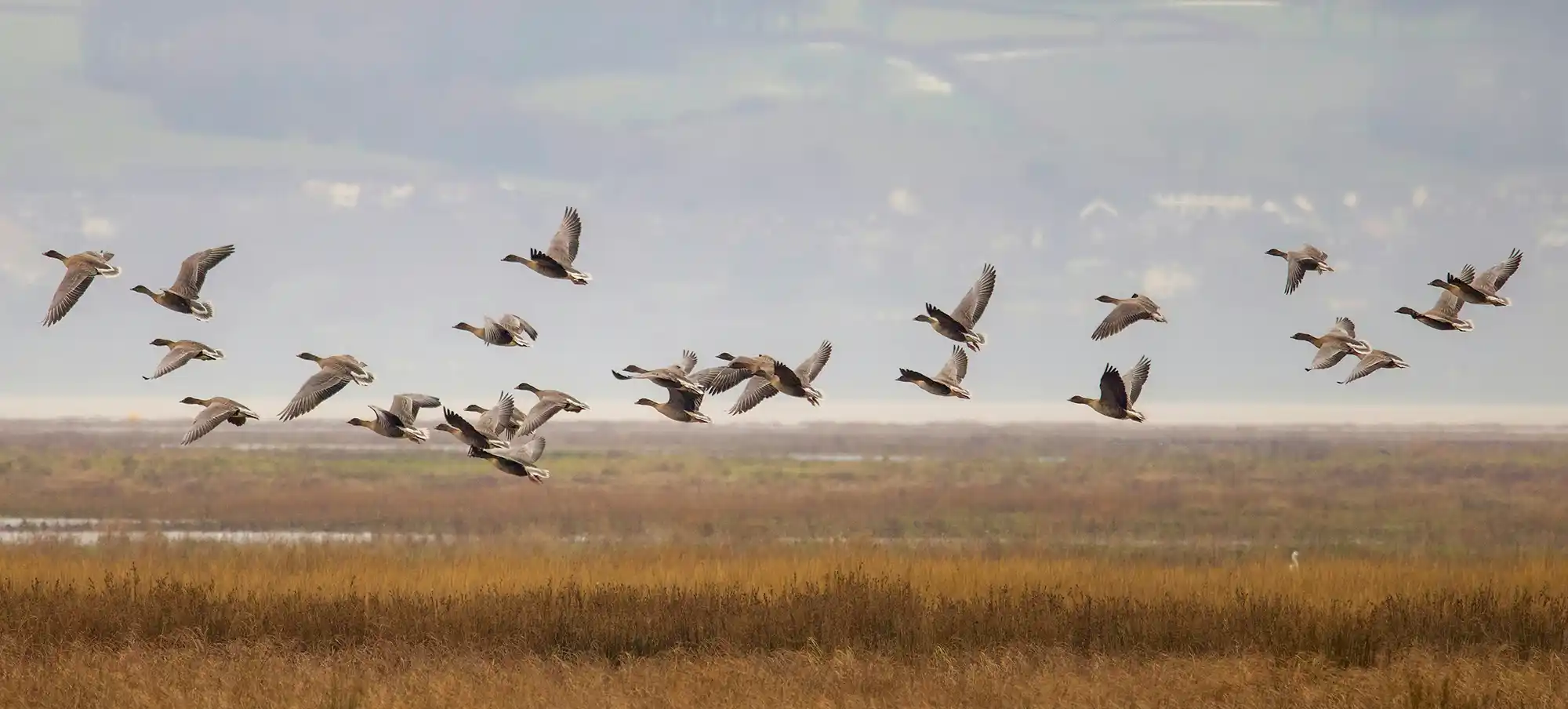
The Wallasea Island Wild Coast Project transformed 850–900 hectares of reclaimed arable land into a dynamic coastal wetland of mudflats, saltmarsh, lagoons, and pasture using a managed realignment strategy. Spearheaded by the Royal Society for the Protection of Birds (RSPB) in partnership with Crossrail, the project reused 3 million tonnes of excavated material from London’s Crossrail tunnelling to shape the landscape and create 115 ha of new intertidal habitat. As Europe’s largest “beneficial use” coastal restoration, the project demonstrates how industry and conservation can collaborate to deliver climate adaptation, biodiversity recovery, and carbon sequestration.
Since the 16th century, Wallasea’s five separate saltmarsh islands were reclaimed and converted to farmland, leaving the site vulnerable to coastal flooding and biodiversity loss. By the early 2000s, sections of the seawalls faced a one-in-five-year risk of failure. The managed realignment aimed to pre-empt unmanaged breaching, restore natural tidal processes, and compensate for habitat losses elsewhere in the UK due to coastal squeeze. The restoration reconnects land and sea, allowing saltmarsh to accrete naturally with rising sea levels while supporting internationally important bird and fish populations.
The project used managed realignment and sediment reuse to restore a complex wetland system resilient to sea-level rise. By breaching sea walls and constructing a new counterwall, tidal exchange was reinstated to a formerly drained agricultural landscape. Sediment from Crossrail tunnelling elevated key areas to prevent excessive inundation, while lagoons and channels were engineered to support diverse intertidal habitats. The design allows the saltmarsh to evolve dynamically, accreting with rising sea levels and sustaining biodiversity and coastal protection functions.
The intervention restored coastal wetland on Wallasea Island (Crouch and Roach estuaries, Essex) through a managed realignment approach combined with beneficial reuse of clean excavation spoil. The Royal Society for the Protection of Birds (RSPB) implemented the works across a large site reported as 900 hectares (also cited as 850 hectares), converting reclaimed arable land into a mosaic of mudflats, saltmarsh, lagoons and pasture. Delivery started in the late 2000s and the main restoration phase ran from 2008 to completion in 2018.
A central implementation component was a partnership with the London Crossrail project to reuse around 3 million tonnes of excavated earth. Crossrail transported the material by barge to Wallasea Island, using a specially constructed unloading facility. The imported spoil was placed to raise land levels above sea level and shape new coastal features. This enabled the creation of approximately 115 hectares of new tidal habitat, including saltmarsh, mudflats and lagoons, and was also used to form elements such as a creek network and grazing marsh.
Managed realignment was achieved by creating breaches in the existing sea walls to allow controlled tidal inundation and the formation of new intertidal habitat. The scheme was explicitly designed to reduce the risk associated with an unmanaged breach of lower seawall sections during storm surges. In parallel, a new counterwall was constructed to improve flood defence for buildings on the western side of the island and to reduce long-term seawall maintenance requirements.
Saline lagoon management is operated through water level control using sluice gates. Natural England manages Allfleets Marsh on behalf of Defra, with the RSPB acting as managing agent for Natural England and undertaking lagoon water management via the sluice gate system. The project also emphasised ongoing site management and monitoring now that the main engineering works are complete.
Monitoring was structured around three strands: pre- and post-breaching impact verification, ongoing assessment of sediment settling and ecological functioning, and post-implementation monitoring of mitigation habitat success. Defra funded a detailed five-year monitoring programme starting in 2007 to assess whether the wetlands meet compensatory habitat targets and to verify that physical and ecological changes in the adjacent estuaries remain within predicted limits. Following completion, the RSPB continued monitoring through paid staff and volunteers, including routine wildlife surveying on the reserve.
Information not available yet.