Chania, Crete, Greece
Project ended
Pilot site
The Koiliaris River Basin faces soil degradation, flooding risks, and ecosystem pressures. The LENSES pilot combines field-level interventions in avocado orchards with landscape-scale scenario modelling to strengthen the Water–Ecosystem–Food–Climate (WEFC) nexus. On the ground, the pilot focuses on monitoring-driven irrigation optimisation and agroecological soil management in avocado farms, supported by high-resolution hydrological and plant monitoring. In parallel, nature-based solutions such as terracing, riparian forest restoration, and managed livestock grazing are assessed through modelling to explore their potential environmental benefits at the river-basin scale and to inform future decision-making.
The 130 km² Koiliaris Basin (36 km river; Mediterranean climate; karst-fed springs) has experienced severe soil and biodiversity degradation from steep-slope cultivation, high-elevation free grazing, and unsustainable agricultural practices. Torrential events exceed infiltration, driving runoff and flooding; loss of forests and natural vegetation adds pressure. Agriculture dominates livelihoods (notably olives, oranges, grapes), and improving resilience and water management is a priority for food security and ecosystem health.
The pilot combines on-farm irrigation optimisation with modelling the deployment of a suite of watershed-scale NbS. In avocado orchards, evapotranspiration-guided circular drip and soil-moisture-triggered scheduling reduce water use and plant stress. Agroecological practices (manure additions, mulching, grass incorporation, no till) and retention of organic residues enhance soil structure and carbon storage. Continuous monitoring and coupled models quantify hydrologic, soil, nutrient and biomass responses to guide management and investment choices. At watershed scale, the project models the deployment of terraces and 40 m-wide riparian forest buffers (both riverbanks) where erosion and sediment export are highest, while upland free grazing is discontinued to aid biodiversity recovery and reduce nutrient pressures.
In the Koiliaris River Basin, nature-based solutions were operationalised through a combination of on-farm demonstration measures in an avocado plantation and scenario-based planning for wider catchment interventions, supported by systematic monitoring, modelling and stakeholder engagement.
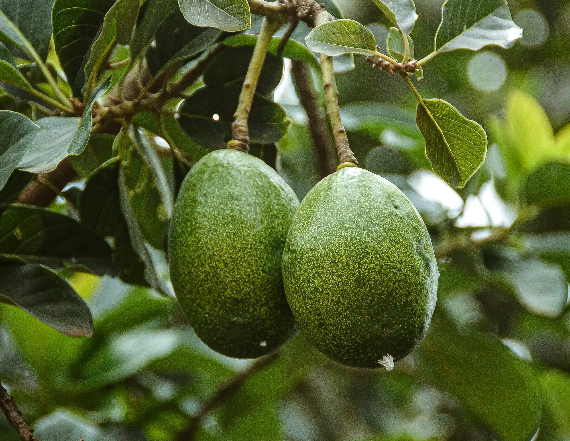
At field scale, a hydrologic and plant monitoring station was established within an avocado plantation to derive and test optimal irrigation schemes. The set-up included a precipitation and meteorological station, soil-moisture profilers positioned both near to and away from trees, irrigation flow monitoring, and NDVI and PRI cameras to track above-ground biomass and detect plant stress. Data were collected at 15-minute intervals and combined with expert knowledge to refine irrigation scheduling and practices. Irrigation volumes were aligned to the trees’ evapotranspiration requirements, and water delivery was targeted to the root zone by applying drip irrigation in a circular pattern approximately one metre in diameter around each tree rather than across the whole field. Irrigation was applied every 3–4 days based on observed soil-moisture changes. This approach reduced irrigation water use to around 30% of typical areal prescriptions and addressed observed plant stress linked to over-irrigation. To reduce energy demand for irrigation, photovoltaic panels were used to provide sufficient energy for irrigation operations.
Soil-focused agroecological practices were implemented to strengthen soil functions underpinning productivity and resilience. No tillage was practiced to avoid disrupting the formation of water-stable aggregates. Organic matter inputs were increased by cutting grass growing between trees and leaving clippings on site, and by retaining avocado leaves within the plantation. In the experimental avocado field assessed through modelling, additional practices included manure addition, mulching and grass incorporation into the soil, alongside sustainable irrigation practices; these practices had been applied in the field since 2010. The plantation described comprised 25 larger trees and 40 smaller trees irrigated through a drip system with 25 and 15 drippers respectively, and manure was applied at 10 kg per tree each December.
At catchment scale, the project used modelling to evaluate the feasibility and likely impacts of nature-based solutions for priority problem areas, rather than describing their physical construction on the ground. For erosion and water-quality pressures in Area 1 (the Keramianos tributary), two solutions were selected through collaboration between the scientific team and local stakeholders: terracing and riparian forest. In modelling, terracing was represented by adjusting parameters associated with slope practice and morphology at hydrologic response unit level in specific subbasins. Riparian forest was represented as filter strips on both sides of the river, with simulations incorporating assumptions on filter strip dimensions (including an assumed 40 m width on both sides of the channel) and parameterisation of runoff concentration and channelisation. Scenarios were tested for terraces alone, riparian forest alone, and a combined approach.
For biodiversity degradation linked to free-grazing livestock in Area 2, the proposed intervention was to discontinue free grazing at high elevations and transition to organised caged livestock systems at lower elevations, with the intent of reducing pressures in upland areas and enabling gradual biodiversity restoration while facilitating manure recycling for agricultural reuse. In modelling terms, this was represented by removing manure fertilisation operations associated with sheep and goats in the relevant areas.
Implementation planning relied on integrated methods intended to support practical decision-making: participatory system dynamics modelling, water accounting, climate risk assessment, and the development of “NbS bundles”, combined with participatory workshops and focus groups (including avocado producers) and engagement with government authorities on water management. Key constraints to implementing the basin-scale measures were reported as legislative, economic, technical and social barriers, including lengthy multi-institution approval processes, challenges in technical design and permitting capacity, and local stakeholder acceptance where interventions could require reclaiming agricultural land for riparian restoration. Reported drivers to address these barriers included developing a shared vision for agricultural development linked to environmental benefits and establishing a decision-making approach to designing and implementing nature-based solutions.
Information not available yet.