Swindale, River Eden catchment, Cumbria, England, United Kingdom
Ongoing implementation
Local level
A straightened, rock-armoured reach of Swindale Beck was reconnected to a newly cut, sinuous channel to reinstate natural river processes in a working farmed valley. The project replaced leveed, uniform flow with a wider, meandering channel, re-establishing gravel bars, riffles and pools, improving floodplain connectivity, and reducing gravel delivery to a downstream drinking-water intake—while retaining productive hay meadows.
Swindale Beck had been straightened (≥160 years ago) and leveed for ~2 km, with rock armouring, uniform depths and velocities, minimal habitat diversity, and limited spawning substrate. The perched channel conveyed high-energy floods and mobilised gravel that deposited at a downstream United Utilities intake, increasing maintenance. Levees also trapped floodwater on meadows, degrading botanical value. Parts of the valley floor are SSSI/SAC hay meadows and rush pastures managed without fertiliser inputs. The aim was to restore river dynamics and ecological quality within an actively managed farm landscape.
The project excavated a new meandering channel following paleochannels and a simple 2D design, then diverted flow from the straightened, rock-armoured course. Levees were removed to reconnect the floodplain. Natural processes were allowed to sort gravels and create habitat features; embryo gravel bars were placed where needed. Approximately 4,000 riparian trees were planted to mature into shade and large woody material inputs. Monitoring tracks geomorphic change, biota, and downstream water quality.
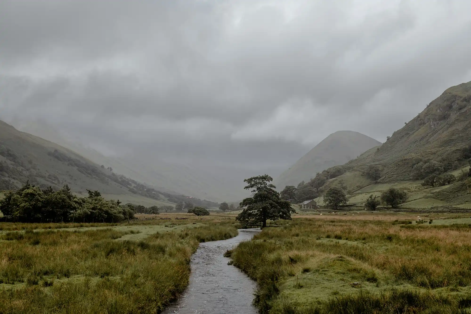
In response to long-term channel modification and floodplain disconnection, the intervention focused on reinstating a more natural, meandering planform and restoring dynamic river processes along a heavily straightened and rock-armoured section of Swindale Beck running through Swindale Farm (Eastern Lake District, Cumbria). The work was implemented within an actively managed farmed valley bottom that includes SSSI/SAC hay meadows and rush pastures.
Selection and design of the intervention were shaped through the RSPB’s management planning process and consultation with the Eden Rivers Trust, which helped identify the opportunity to restore sinuosity and enhance biodiversity. In 2015, geomorphologists from the Environment Agency used a digital elevation model alongside mapped paleochannels (visible as wetter, low-lying former channel traces) to set out the route of a new sinuous channel. Lessons from previous schemes supported by the Cumbria River Restoration Strategy informed the approach: rather than detailed engineering designs, the project relied on establishing a basic channel and allowing fluvial processes to generate habitat features (e.g., gravel bars, riffles and pools) once flow was reconnected.
Because the new channel alignment crossed designated meadow and pasture, implementation required an Appropriate Assessment under the Habitats Regulations. Natural England supported the works on the basis that impacts would be positive overall. The channel excavation was routed mainly through areas described as almost permanently wet and of comparatively lower botanical and agricultural value. Where small areas of more species-rich grassland would be disturbed in the short term, the approach included reinstating hay meadow on the former straightened channel after it was in-filled, with the intention of increasing the extent of usable, species-rich meadow over time. The intervention also aimed to reintroduce a more natural flooding regime and create new colonisation niches, supported by the availability of local seed sources from hay meadows managed across the valley bottom with no fertiliser inputs and carefully timed grazing.
A specialist environmental contractor (OpenSpace) began on-site works in March 2016 following tendering. Delivery was challenged by weather and numerous land drains, which repeatedly inundated the work area. In some reaches, insufficient gravel along the new route raised concerns that the restored channel could be more dynamic than desired, potentially affecting surrounding land. To increase stability, the works included constructing a number of “embryo” gravel bars in locations where bars were expected to develop naturally, providing initial structure while still relying on natural sediment transport and deposition.
Before diverting flow, electro-fishing was undertaken to remove fish from the straightened channel. The river was then connected into the new sinuous course in August 2016. A major rainfall event two days later flooded the valley bottom.
Although there were concerns about erosion of newly formed, unconsolidated banks, the flood ultimately accelerated establishment of natural channel features: high flows delivered gravel that in-filled reaches previously lacking bed material, reshaped and enlarged the embryo bars, and generated additional bars, riffles and pools. The restored channel was described as immediately more morphologically diverse than the former straightened route. The new channel length was 891 m (approximately 140 m longer than the prior alignment) and around 2 m wider, and it was implemented without the historical levees, improving floodplain connectivity.
The intervention also included riparian habitat enhancement through tree planting: around 4,000 trees were planted along the river corridor in winter 2016/17 to provide future shading, woody debris inputs, and additional habitat. Part of the restored corridor was to be fenced to develop a wooded section, while the section running through the SSSI was to remain open.
While not framed as a full “rewilding” scenario, the implementation deliberately prioritised restoring natural river dynamics within a managed agricultural landscape. Options such as removing livestock, blocking land drains, or being less prescriptive about channel routing were considered but not pursued, in order to retain and enhance hay meadows and maintain traditional hill farming practices while still re-establishing geomorphological and hydrological processes.
Information not available yet.